We’re lucky with the weather today as this summer has been pretty appalling with the unprecedented levels of rainfall we’ve had all over the country, but today promises warm sun on our backs and hopefully some spectacular views to go with it…
+across+Cam+Fell+from+Gearstones.jpg)
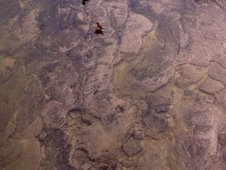
Cam Fell with Gayle Beck at its foot from Gearstones.
The River Ribble begins its long journey to the Irish Sea above Ingleborough and Pen-y-ghent in the Yorkshire Dales. Forming in the horse-shoe-shaped bowl of North Yorkshire fells above Ribblehead created by Blea Moor below Whernside, Wold Fell below Great Knoutberry Hill, and Cam Fell. The first two of these fells have little or nothing to do with forming the Ribble’s headwaters, however, Cam Fell performing this honour with Gayle Beck and Cam Beck. Of course, the beginnings of the River Ribble are in the merging of the numerous springs and gills and becks which make their way down to the valley floor from the limestone fells in this part of North Yorkshire, particularly from the West and Eastern faces of Cam Fell, with contributions from Blea Moor, Park Fell on the North-East side of Ingleborough, and eventually yet more from the West and Southern sides of Pen-y-ghent – many of these gills dropping below ground into the labyrinth of pot holes and caves which weave beneath these limestone fells, only to emerge again elsewhere (some apparently bizarrely, as noted by Ron Freethy in his book “The River Ribble”, telling the tale of the geologists who dropped green dye into Alum Pot to see where it fed into the Ribble only to find it emerging out of Tarn Dub, showing that it had actually passed beneath the Ribble to get there!)
Gayle Beck forms on the Western face of Cam Fell and Cam Beck on the East, and the question of which is the Ribble’s true source is to a large extent academic as both feed the start of the Ribble at Selside, and both are formed by springs which emerge from their eons percolating through the limestone crags at the summit of Cam Fell and both are fed by the water which drains from the blanket bog which literally forms a blanket over the fell. The gills which spring from the Western face above Gayle Moor denote the headwaters of the Ribble – Jam Syke, Shivery Gill, Long Gill, Mares and Far Mares Gill, and Lat Gill, with Jam Syke and Shivery Gill as the foremost sources as these Springs emerge on Little Wold at the highest point below the summit and are never dry, thus officially mark the source of the Ribble’s headwaters.
Here on the Western face of Cam Fell, these springs and gills wend their way across Gayle Moor to form Gayle Beck, which then flows South-West to meet Cam Beck below Selside Moss where it officially becomes the River Ribble.
Yet, for those who have visited the point where Gayle Beck strengthens and widens and cuts its way through the limestone of Cam Fell to finally emerge into the valley floor at High Flat Hill below Gearstones, this spot seems to be the point where the River proper begins. We can’t be the only people to think so as the nearest settlement is called Ribblehead and the emergence of this body of water occurs near a house called Ribblehead House…
Labelling Nature with our own names is probably more often a personal preference than a scientific process, but if map-makers and official agencies name the River Ribble from the point where Gayle Beck and Cam Beck meet, who are we to argue…? Nonetheless, our own journey down the Ribble Way will include a sideways trip to where Gayle Beck cuts its path through to the valley floor at High Flat Hill as one of a number of interesting diversions…
But the question of where Gayle Beck becomes the River Ribble is for the second and third parts of our journey: today we are on a quest for the source of the Ribble’s headwaters on Gayle Moor…
We park at Gearstones, just East of Ribblehead, planning to creep up on the source on Gayle Moor from behind by walking to the top of Cam Fell from the South-West and round anti-clockwise to the East then Northwards on the old Roman Road. This route forms part of the Dales Way then also the Pennine Way as it follows the ridge of Cam Fell. At the summit we’ll leave this path and turn to the West across the top of Cam Fell to the Western side of the summit and Gayle Wolds – the limestone crags just below the limestone pavement summit of Cam Fell and the start of the headwaters of the Ribble down to Gayle Beck. The source also marks the beginning of the Ribble Way (as you’d expect!) which starts its own journey at Gavel Gap, just below Gayle Wolds.
Through the first gate onto the Dales Way...

...takes us past a few of the locals...

...and Gayle Beck, the Ribble’s source waters already a substantial size having gathered the momentum of Jam Syke and all of her sisters as it has made its way down from Gayle Moor.

Gayle Beck at the foot of Cam Fell...

...promotes some serious contemplation.
There is a bridge running alongside a ford over Gayle Beck and onto the Dales Way, the waters low enough to flow beneath the stones of the ford and leaving the path across easily dry enough to cross...
+&+Gayle+Beck.jpg)
The Dales Way is an old Roman Road, the eroded causeway showing its anatomy and its incredible longevity as we make our steady way up towards Cam End and where it meets the Pennine Way at the beginning of the walk up the ridge to the summit.

The Dales Way onto Cam Fell as it leaves Gayle Beck.

Best feet forward...

...race you to the top!
The intimate details of Cam Fell and the surrounding fells reveal themselves as we climb...

Grasses and peaty mud soon give way to gills, pools and blanket moss as we climb...

The gills and bogs and blanket bog are a fantastic upland wetland habitat...

...and there are hidden gills too...

...so you have to watch your step if leaving the path as the ground can be sodden.
Blanket bog mosses...
...are well worth getting soggy knees to get a closer look!

The back end of Pen-y-ghent...

...and the view back down towards Cam Beck and Whernside.
Cam Fell is covered with blanket bog, an increasingly rare and precious habitat which manages and stores our water resources where they begin, and also prevents flash floods into the valleys below as well as providing a rich and diverse habitat for countless flora and fauna…
There are numerous species of wildflowers up here too...

...including Fairy Flax (I think!)...

...and Self-Heal...

...amongst many other species.
These upland moors are also home to important numbers of bird species, including Merlin and Golden Plover. We saw a couple of Plover and several Grouse (mainly disturbed beneath our feet when we left the path to explore the bogs a little more), as well as Skylarks and other small birds, no doubt doing very well on a diet of the Crane Fly (“Daddy Long Legs”) which flourish here.

Insect larvae on the mosses.
The views were as spectacular as the weather promised...

...and we had glorious views of Whernside first of all, then Ingleborough and Pen-y-ghent as we moved round to the ridge path all the way to the top of Cam Fell, as well as a hazy view of Pendle Hill in the distance…

Towards Ingleborough from Cam Fell as we climb the Dales Way and Pennine Way...

...Ingleborough and Park Fell...

...Pen-y-ghent...

...and Pendle Hill.
It’s a shame the route doesn’t also afford a view of Wold Fell and Widdale above Cam Fell but the path is below the top of the ridge – although this is no doubt a blessing in a North wind when Gayle Moor undoubtedly lives up to its name from what we hear of the winds up here!

Swathes of trees in Cam Woodland have been felled by the wind which sweeps across these fells.
We stopped half way along the ridge walk (now the Pennine Way as well as Dales Way) above Cam Woodlands for an unbeatable view whilst munching our way through our packed lunches…

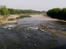
Cam Beck...
Cam Beck emerges from the Eastern slopes of Cam Fell, and meets the Ribble a few miles downstream of Ribblehead below Selside Moss, but other springs from the Eastern side of Cam Fell as this curves round to the East below Dodd Fell Hill move in a different direction entirely. These springs and gills follow a slightly different camber to travel East instead of South-West, becoming Oughtershaw Beck, then the River Wharfe and then flowing into the River Ouse and finally the Trent before draining into the Humber Estuary and the North Sea on the East coast of Northern England - almost parallel with the Ribble Estuary on the West coast – yet these springs emerge only a few metres away from those which feed Cam Beck and the Ribble’s waters before heading in the opposite direction towards the Irish Sea.

We also took time to instigate a few emergency repairs to heels in new boots...
...then refreshed and replete, we set off again, and pass our first spring which emerges suddenly from beneath the mosses…

As we move beneath the summit of Cam Fell we take a small diversion and climb the steep mossy slope to the top to explore the limestone pavement here…

Limestone pavement on Cam Fell.

The mosses which thrive on the limestone pavement.

At the top of Cam Fell.
As we emerge from the gate to Camm Farm (Cold Kell Gate), we press ahead as far as the signpost at Kidhow Gate before realising we should have turned sharp left at Cold Kell Gate to cross the summit over towards Gayle Moor, but the mistake turned out to be well worth it as the limestone along here is so bare and well-worn that we marvel over the clearly visible remains of the myriads of fossilised sea-creatures which have formed this fantastic mountain landscape…

Cutting back across the Northern face of the limestone pavement summit of Cam Fell, we get views across Snaizeholme Fell, Widdale Fell, Great Knoutberry Hill and Wold Fell before finally finding our goal: Gavel Gap, the start of the Ribble Way and marking our quest for the Ribble’s source…

At Gavel Gap, the beginning of the Ribble Way. Now, where's that source...?

Just up from the gate at Gavel Gap is Little Wold, the source of Jam Syke... our steps quicken as we search for the source of the Ribble…

Eureka!!
We find the spring of Jam Syke very quickly and are genuinely amazed at how beautiful it is: a steady trickle of fresh, clear, sparkling water, emerging from a crack in the limestone and flowing across a flat step before trickling down through the mosses into its blanket bog lined gill.


The only way to celebrate is to fill our water bottles from this steady flow and toast the River Ribble! As we fill the first bottle the inevitable joke “oops, Ribble suddenly runs dry at Preston” causes merriment, and we inspect the water in the bottles – removing the accidental wriggly creature dislodged from the mosses – and marvel at the clear water we hold in our hands before toasting the Ribble and drinking the cold and quite delicious water.

Gayle Wolds: the source of the Ribble.
After celebratory chocolate biscuits, washed down with more Ribble water and digested with a fabulous view over Gayle Moor towards Blea Moor and Whernside rising behind the Ribble viaduct...

...we follow Little Wold round the West of the summit towards the other limestone blocks which form the rest of Gayle Wolds...
Shivery Gill comes from Little Wold as Jam Syke does, and it too is a splendidly clear spring, albeit more densely dressed in its mosses than Jam Syke.

Shivery Gill emerges from its mossy source.
We walk back round to Jam Syke, and the sun is shining on the gill...

...as it flows down to meet its sisters in Long Gill and then Gayle Beck...

...and we set off down the first part of the Ribble Way path as it makes its way down Gayle Moor.

The Ribble Way down from Gayle Wolds, following Jam Syke and then Long Gill before turning towards Blea Moor.
Jam Syke eventually joins with Long Gill...

Long Gill.
...as does Shivery Gill, Far Mares Gill, Mares Gill, Lat Gill, High Springs, and White Earth Gill, and by this time they have all become Gayle Beck and are making their way down towards Ribblehead.

Another spring joins with Long Gill on its way down to join Gayle Beck.
We follow Jam Syke then Long Gill towards the West then South-West down Gayle Moor to White Rake, but then the Ribble Way turns slightly North to Newby Head Moss and on to the next stage of our journey which sees the Ribble’s source waters left making their way to the valley floor in a South-South Westerly direction while we set off across to the West and the opposite slopes of the valley on Blea Moor.
Once on Blea Moor, the Ribble Way takes a sharp left turn where it meets with the Dales Way once again...
...and we enjoy a ramble along the mainly gentle slopes of Blea Moor...

...even encountering a few small birds with an unusual sound which we think were either Whinchat or Stonechat...

...with great views over to Gayle Moor and Cam Fell where the Ribble's waters begin their long journey...

...and with increasingly fabulous views down the valley as Blea Moor curves gently round towards Pen-y-ghent, Ingleborough and Whernside...

Ouster Gill wends its way down from Blea Moor to join Long Gill and Gayle Beck.

Pen-y-ghent from the Ribble Way at the lower end of Blea Moor.
The Ribble Way and Dales Way on Blea Moor follows the line of Long Gill at the foot of Gayle Moor (although they can't be seen from here) as we make our way South across the lower East slope of Blea Moor down towards Gayle Beck at Gearstones, back to the beginning of today’s journey seeking the Source of the River Ribble...

Looking over Gayle Beck back towards Cam Fell at the beginning and the end of this circular walk.
We walked about 8 or so miles in total today – a good achievement for the three members of the party between the ages of ten and twelve – 2 children keen to amble along at their own leisurely pace and one dog with rusty hips!
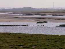
We plan the next stage before setting off home: this will be from Gearstones to Horton-in-Ribblesdale, with one particular diversion: a trek off the beaten track down to Gayle Beck at High Flat Hill – a spot which declares itself a serious contender as one of the most beautiful sections of the Ribble, as well as instilling many locals and visitors with the conviction that this section should be named the River Ribble from this point on…
Part 2 of our Ribble Way adventures will be blogged next week as we play "Spot the Ribble"...
... and Part 3 of The Ribble Way involves Dry-Ski Slopes and a Swim at Selside!
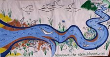
You can contact me at savetheribble@tiscali.co.uk


No comments:
Post a Comment